No Atlantic hurricanes hit Mexico throughout September. That’s not normal.
The eastern coast of Mexico made it through September without a hurricane as the Atlantic basin recorded its first hurricane-free September in more than three decades.
On the country’s Pacific side, however, the storms kept churning.
Through Wednesday, the Pacific basin — which stretches from the Americas westward to the International Date Line — had produced 20 named storms and nine hurricanes during a 2026 season that began May 15.
Three of those hurricanes reached Category 5: Hurricane Genevieve, well off Mexico’s Pacific coast in July; Hurricane Lowell, which formed in the Eastern Pacific in August and moved toward Hawaii; and Hurricane Polo, which pounded the Baja Peninsula and the Sonora coast in September.
Meanwhile, no Atlantic storm had reached hurricane strength through Oct. 1, although the current Tropical Storm Isaias could change that.
A major driver is a “super” El Niño creating exceptionally warm equatorial Pacific waters.
According to specialists at the National Autonomous University of Mexico (UNAM), warmer water from the central equatorial Pacific is shifted by El Niño toward the northeastern Pacific off Mexico, providing more energy for cyclones to form and intensify. Plus, El Niño tends to reduce vertical wind shear in the eastern and central Pacific, making conditions more favorable for hurricanes.

In the Atlantic, El Niño tends to increase vertical wind shear — changes in wind speed or direction with altitude — which can tear apart developing storms.
The contrast was forecast months ago, when Mexico’s National Meteorological Service (SMN) projected 18 to 21 tropical cyclones in the eastern Pacific and 11 to 15 in the Atlantic.
September further illustrated the contrast.
Historically the statistical peak of the Atlantic hurricane season, September was hurricane-free in the Atlantic for the first time since 1994.
The only other such Septembers since 1950 were in 1972 and 1962, according to Colorado State University hurricane researcher Phil Klotzbach.
All of that being said, the 2026 Atlantic lull might be over.
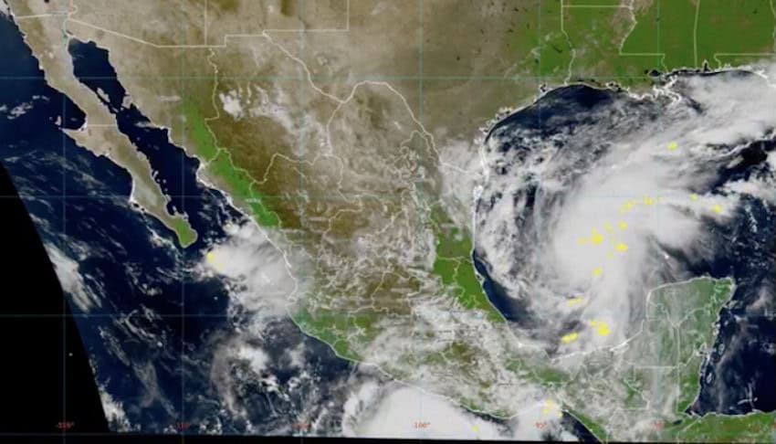
Tropical Storm Isaias formed Wednesday in the southwestern Gulf of Mexico, north of Veracruz and west of the Yucatán Peninsula, and was forecast to become the season’s first Atlantic hurricane. Its maximum sustained winds were charted at 45 mph at 9 a.m. Mexico City time Wednesday.
The National Hurricane Center (NHC) forecast Isaias to reach hurricane strength, with winds of at least 75 mph, early Thursday and peak early Friday at 110 mph, near the top of the Category 2 range.
Though increasing wind shear could weaken Isaias before landfall, the NHC expected it to reach the southern U.S. late Friday or early Saturday.
Before that, the storm could bring 5 to 10 centimeters (2 to 4 inches) of rain around the Bay of Campeche and the Yucatan Peninsula.
Both hurricane seasons run through Nov. 30.
With reports from El Horizonte, Smithsonian magazine, KABC and BBC
KioskNews shows a cleaned-up reading view extracted from the publisher’s page — the original always lives on their site, not ours.