Rosal slightly accelerates; signal No. 1 still up in 6 areas
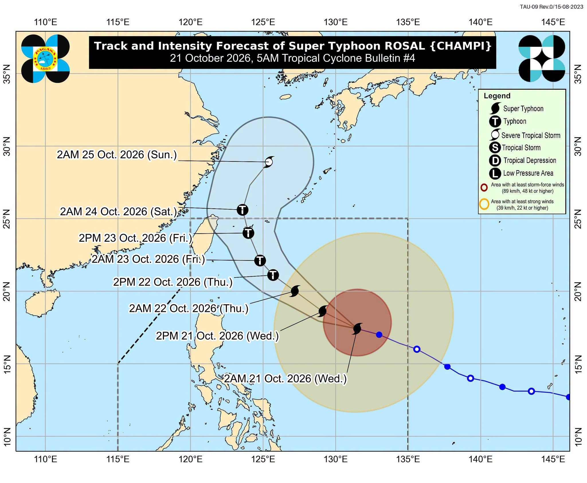

MANILA, Philippines — Tropical Cyclone Wind Signal No. 1 (TCWS) remained hoisted over six areas in northern and southern Luzon as Super Typhoon Rosal (international name: Champi) slightly accelerated over east of northern Luzon on Wednesday morning, according to the state weather bureau.
In the 5 a.m. weather bulletin of the Philippine Atmospheric, Geophysical, and Astronomical Services Administration, Rosal was last estimated 990 kilometers east of Northern Luzon. It was moving west northwestward and slightly accelerated from 25 kilometers per hour (kph) from the previous update to 30 kph.
READ: Signal No. 1 raised in 6 Luzon areas due to Super Typhoon Rosal
Article continues after this advertisement
Rosal maintained its strength as it was still carrying wind speed of 215 kph and gustiness of up to 265 kph.
FEATURED STORIES
NEWSINFO
NEWSINFO
NEWSINFO
Pagasa then said that TCWS No. 1 was still raised over these following areas, where wind speeds range from 39 kph to 61 kph.
- Batanes
- Babuyan Islands
- Northern portion of Ilocos Norte (Pagudpud)
- Northern and eastern portions of mainland Cagayan (Santa Ana, Gonzaga, Lal-lo, Santa Teresita, Camalaniugan, Aparri, Buguey, Gattaran, Baggao, Peñablanca, Santa Praxedes, Claveria, Sanchez-Mira, Pamplona, Ballesteros, Abulug, Allacapan)
- Northeastern portion of Isabela (Maconacon, Divilacan, Palanan)
- Northeastern portion of Catanduanes (Pandan, Bagamanoc, Panganiban, Viga, Gigmoto)
READ: Pagasa: Northern portions of PH to be most affected by Rosal
The bureau also noted that residents of these areas have 36 hours warning time amid the potential minimal to minor threat to life and property of the strong winds. It maintained that the highest wind signal that may be raised during the passage of Rosal in the country is signal no. 2 or 3.
Meanwhile, the northeasterly wind flow and Rosal’s periphery will bring strong to gale-force gusts over the following areas:
- Wednesday, October 21: Ilocos Region, Cordillera Administrative Region, Cagayan Valley, Bicol Region, Romblon, Eastern Visayas, Siquijor, Bohol, Northern Mindanao, Caraga, Davao Region, and Sarangani
- Thursday, October 22: Most of Luzon and Visayas, Zamboanga del Norte, Northern Mindanao, Agusan del Norte, Surigao del Norte, Dinagat Islands, Sarangani, Davao Occidental, Davao Oriental
- Friday, October 23: Most of Luzon and Visayas, Camiguin, Misamis Occidental, Lanao del Norte, Dinagat Islands, Davao Occidental, Davao Oriental
KioskNews shows a cleaned-up reading view extracted from the publisher’s page — the original always lives on their site, not ours.