UK set for ‘exceptionally warm’ weather later this week, Met Office says
Britain is set to enjoy “exceptionally warm” weather for the time of year, the Met Office has said.
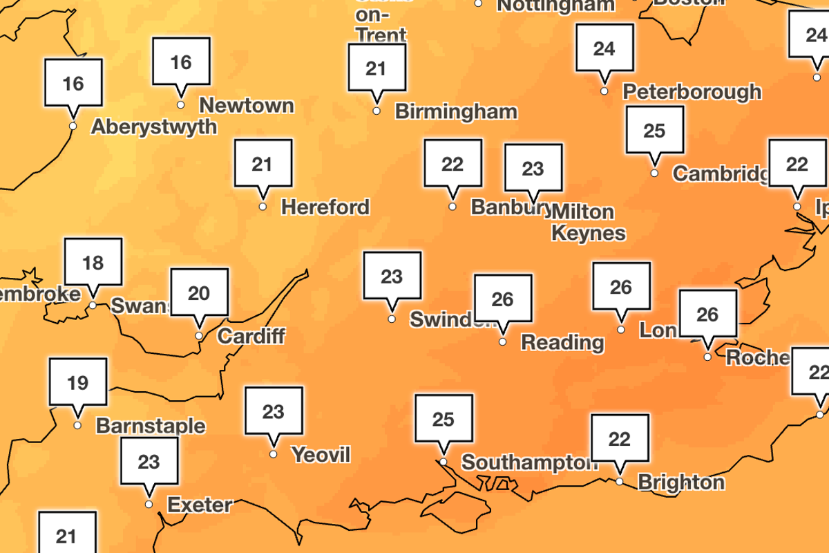
Warmth will build across southern England over the next couple of days, before peaking between 27C and 28C in parts of the South East on Friday, the Met Office added.
Thursday is expected to remain mostly dry for many, with temperatures reaching the low-20Cs across much of England and Wales.
Areas further to the north-west, starting in western Scotland and Northern Ireland, will encounter a cold front bringing rain by Thursday afternoon, leading to more mixed weather over the weekend.
The spell comes as widespread parts of England, including London and the South East, stay in drought following an extremely dry spring and summer.
The period was characterised by successive heatwaves and hot weather, putting added pressure on water resources.
Met Office deputy chief forecaster Dan Holley said: “Once early fog patches clear in the south, Friday will be exceptionally warm for late September, especially in the south-east closest to an area of high pressure over the nearby continent.
“A weakening cold front will drift gradually south-eastwards overnight and into Saturday, with temperatures falling back closer to average over the weekend.
“This sets up a mixed weekend of weather, much of Saturday will be fine and dry before an increasing chance of rain or showers on Sunday, especially in more western parts.”
The Met Office said there are emerging signals for “increasingly wet and windy weather next week”.
The weather service said there are increasing signals of a period of wet and windy weather on Tuesday and into Wednesday, with the chance of some coastal impacts in the west and south-west.
Mr Holley said: “While details are naturally uncertain at this range, a particularly deep area of low pressure could pass close to the UK during the first half of next week.
“This may bring some wet and windy weather for some, which coupled with high spring tides could bring impacts to some coastal areas in the west.”
KioskNews shows a cleaned-up reading view extracted from the publisher’s page — the original always lives on their site, not ours.