Tibetan river hosting world’s biggest dam is facing increasing flood risk: study
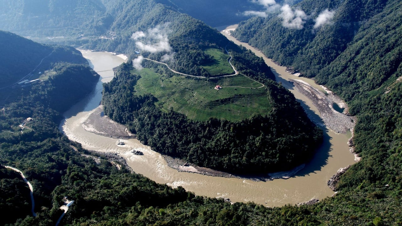
The researchers from the Chinese Academy of Sciences and Yunnan University said future run-off should be considered in planning “water resource development and storage infrastructure” and in assessing transboundary water risks in the region.
The Yarlung Tsangpo River originates near a glacier in the western Tibet Uygur autonomous region and eventually turns south into India, where it is known as the Brahmaputra.
The river is the site of the world’s largest planned hydropower project, which is expected to have a total installed capacity of more than 60,000 megawatts upon completion – three times that of China’s Three Gorges Dam, the largest operating in the world.
The mega dam is being built in Medog, also known as Motuo in Chinese, a border county in southeastern Tibet close to the disputed border with India.
The project has drawn ire from India and Bangladesh downstream – where the river is an important source of water for millions of people – including concerns over water supply and the environment.
01:19
China breaks ground on world’s largest hydropower dam in Tibet
The Tibetan Plateau has been warming at about twice the rate of the global average over the past century, which has impacted the region’s ice cover and hydrological cycle, according to the Chinese team.
Among the rivers in the plateau, the Yarlung Tsangpo experiences the most run-off – or the movement of excess water or snow over land that eventually finds its way to bodies of water or drainage systems.
They emphasised that changes in the river not only reflect the hydrological system within the plateau but also impact drought and flood patterns in South Asia.
“In recent years, with the ongoing warming of the climate, the hydrological regime of the Yarlung Tsangpo River basin has been undergoing significant changes,” they said.
Rising temperatures have accelerated glacial melting, increased permafrost degradation and shortened the duration of snow cover. Rain distribution has also become more unstable, with a rise in extreme rain events and anomalous run-off.
Research has indicated that the region will trend towards a wetter climate, putting the Yarlung Tsangpo more at risk of both water scarcity and flooding.
“However, our understanding of these hydrological changes remains severely constrained by data availability,” the team said.
“Due to complex terrain, high-altitude environments and historical observational limitations, systematic and continuous hydrometeorological records for the basin generally only date back to the mid to late 20th century.”
To reconstruct the river’s hydrological history, the team turned to tree rings as a climate proxy.
Each ring signifies about a year of a tree’s life. The structure of the rings can show what kind of conditions they were formed under.
Wider rings can mean more water during the growing season, and narrower rings less. These patterns can be used to form a climate history that can cover hundreds of years, according to the US National Oceanic and Atmospheric Administration.
The Chinese team said the width and density of rings could be sensitive to moisture conditions during the growing season.
Samples were collected between 2008 and 2020 from 11 sites of high-altitude, moisture-sensitive cypress and spruce trees using borers.
Along with available data from the Nuxia Hydrological Station, these samples were used to reconstruct water-year run-off from 1325 to 2020.
Located in Milin county-level city near Medog, the station is a key monitoring node on the lower reaches of the river.
They found that run-off had exhibited inter- and multidecadal variability over the last 700 years, with 14 wet periods and 14 dry periods.
The run-off that occurred within the period for which there have been instrumental records at the Nuxia station remains within the range of historical natural variability.
The team then incorporated climate data to create a model of monthly run-off at the station from 2030 to 2100.
05:00
A ‘super’ El Nino is forming: what is it, and what’s coming?
This projected an increase in run-off in the Yarlung Tsangpo River during the 21st century, which was “accompanied by a possible increase in the occurrence probability of high-run-off events”.
Under the middle-of-the-road and high-emissions climate scenarios used by the Intergovernmental Panel on Climate Change, run-off was estimated to increase by about 20 per cent and 29 per cent respectively compared to the reconstructed historical period.
“Overall, future annual run-off levels are expected to exceed those observed during both the reconstructed and instrumental record periods,” the team said.
Projections of the distribution of run-off also suggest that there will not only be an increase in mean run-off but also a higher probability of extreme high-run-off events.
The researchers said that for future management, it was “necessary to pay attention to both water resource increase potential and flood risk”.
“Consequently, future basin management must holistically address the interplay between water resource utilisation, flood risk mitigation and the maintenance of ecological water requirements within the context of long-term hydrological change.”
This latest study is not the only recent indication that the region will require careful management in the process of building what will be the world’s largest dam.
In June, Chinese geologists said they had found that an active fault line directly beneath the planned project could pose a threat to its integrity and urged engineers to implement measures to mitigate the risk of collapses and landslides.
KioskNews shows a cleaned-up reading view extracted from the publisher’s page — the original always lives on their site, not ours.