Storm Cempaka retains strength ahead of PAR entry
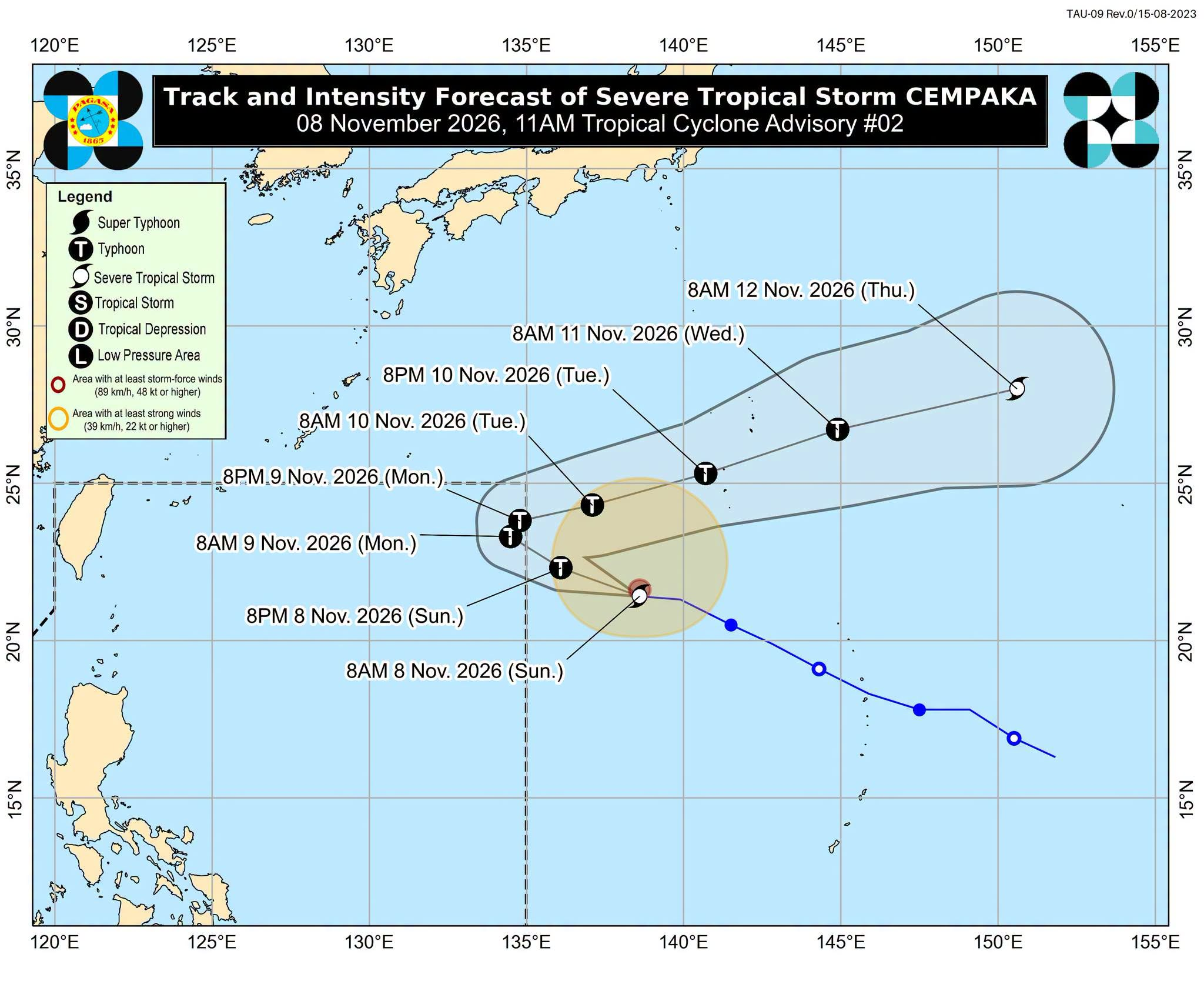

MANILA, Philippines — Severe Tropical Storm Cempaka maintained its strength on Sunday morning ahead of its expected entry into the Philippine area of responsibility (PAR), when it will be given the local name Samuel, according to the weather bureau.
In its 11 a.m. bulletin, the Philippine Atmospheric, Geophysical, and Astronomical Services Administration (Pagasa) said Cempaka was last estimated 1,720 kilometers east of extreme northern Luzon as of 10 a.m.
READ: Severe tropical storm may enter PAR Sunday night or early Monday
Article continues after this advertisement
It was carrying maximum sustained winds of 110 kilometers per hour (kph) and gusts of up to 135 kph. It was moving westward at 25 kph.
FEATURED STORIES
NEWSINFO
NEWSINFO
NEWSINFO
Pagasa said Cempaka “will continue moving generally west-northwestward until it enters the PAR between this evening and Monday early morning.”
Once inside the PAR, it will be given the local name Samuel, becoming the country’s 19th tropical cyclone this year.
“The TC [tropical cyclone] will briefly stay inside the PAR, as it is forecast to begin to turn north-northeastward by Monday afternoon or evening and exit through the northeastern boundary of the PAR,” it added.
READ: ‘Very strong’ El Niño now active in tropical Pacific, says Pagasa
Article continues after this advertisement
Pagasa said Cempaka is forecast to intensify into a typhoon on Sunday but weaken by Tuesday.
Although it is not directly affecting the country, the northeast monsoon will cause moderate to rough sea conditions over the seaboards of Northern and Central Luzon within the next 24 hours. /mcm
KioskNews shows a cleaned-up reading view extracted from the publisher’s page — the original always lives on their site, not ours.